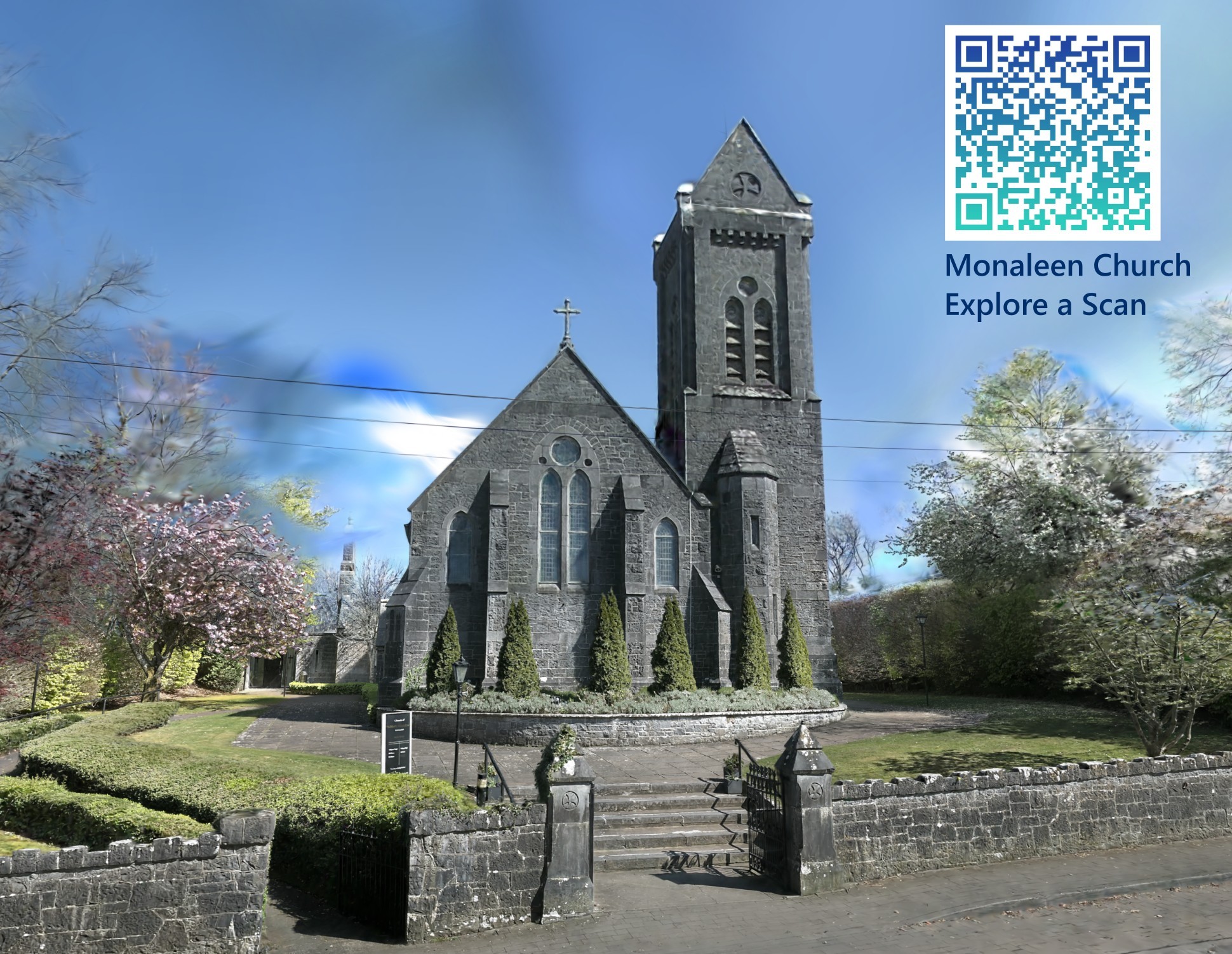
Treaty 3D - Home, Heritage & Hospitality

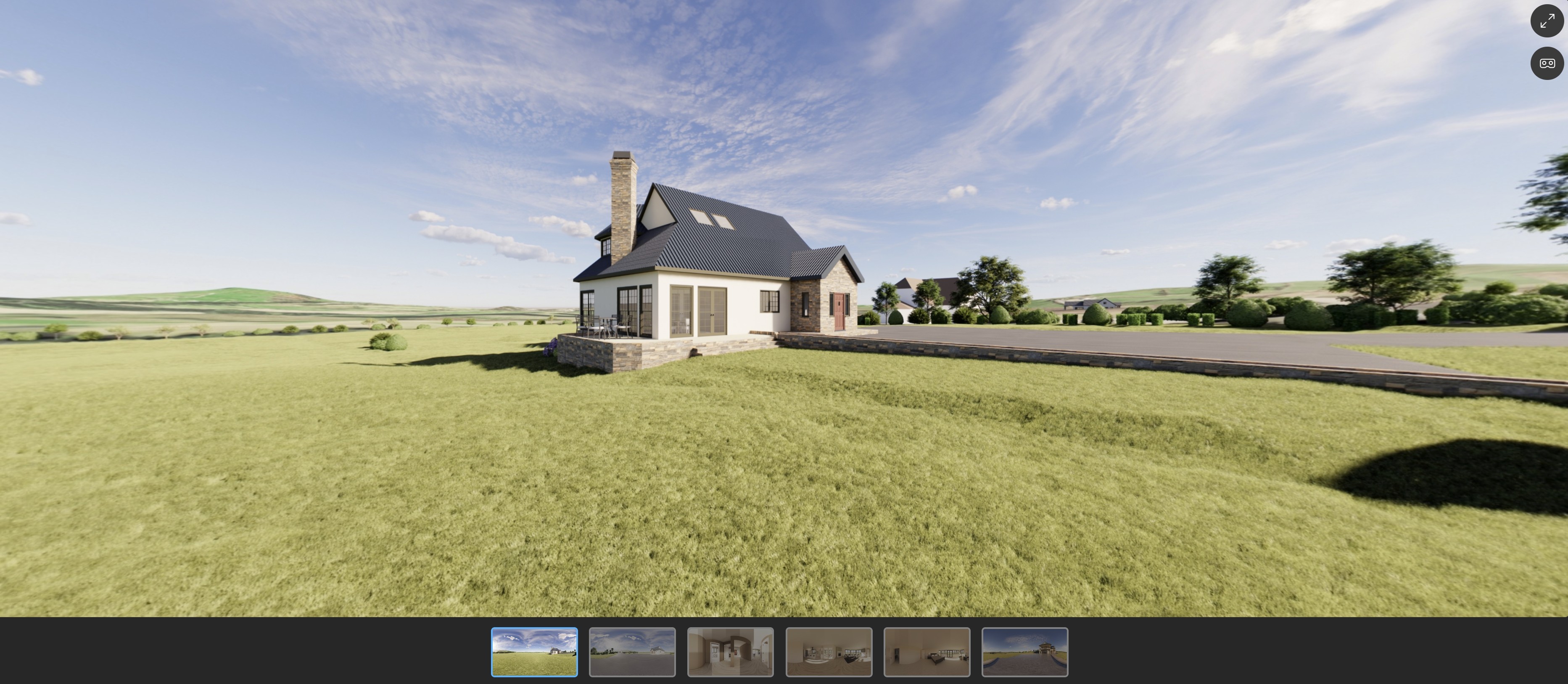
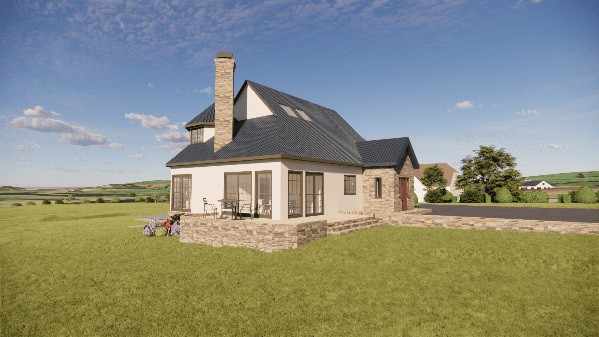
Capture Every Detail

Fast 3D scans, accurate 2D/3D plans, and stunning design visuals to bring your project to life with clarity.

Who We Help:
  • Homeowners & Renovators
  • Guest Accommodation & Airbnb Hosts
  • Landscapers & Garden Designers
  • Real Estate Professionals
  • Local Businesses
  • Heritage & Civic Groups
  • Wedding & Event Planners
What We Offer:
  • Rapid SLAM Scanning (Interior & Exterior)
  • 2D Floor Plans, Elevations & Site Plans
  • 3D Rendered Visuals & Interactive Tours
  • Landscape & Garden Planning
  • Drone & Photogrammetry Capture
  • Design Support & Quantity Take-Offs
  • Shareable Viewer Links & Documentation
From Renovation to Promotion
Whether you’re upgrading a home, pitching to a planning board, or attracting guests online — we help you visualise your space beautifully and accurately.
Need to bring your plans to life before you build? Need a record of an old property before work begins? Or just want to show off your space? We’ve got you covered.
Why Treaty 3D?
Local Service, Professional Results
Based in Ireland, we serve clients across Limerick, Munster and beyond — delivering studio-quality visuals with a friendly local touch.
No Plans? No Problem.
We scan existing spaces and create all-new documentation — even if you’ve never had drawings before.
Ready to Share
We’ll send your files in formats perfect for sharing with architects, contractors, planners, or your audience.

Use Cases:

  • Rapid on-site capture for as-built or topographical modelling
  • Indoor/outdoor SLAM scans for clash detection
  • Scans for VR/AR or Unreal workflows
  • Drone scans of large campuses or infrastructure
  • Cinematic previsualisation or scene planning

Industries & Use Cases:

  • Residential & Private Property Owners
  • Landscaping & Garden Designers
  • Builders, Trades & Planning Consultants
  • Property Sellers & Estate Agents
  • Guest Accommodation & Short-Term Rentals
  • Civic & Heritage Projects

Use Cases:

  • Rapid on-site capture for as-built or topographical modelling

  • Indoor/outdoor SLAM scans for clash detection

  • Scans for VR/AR or Unreal workflows

  • Drone scans of large campuses or infrastructure

  • Cinematic previsualisation or scene planning